
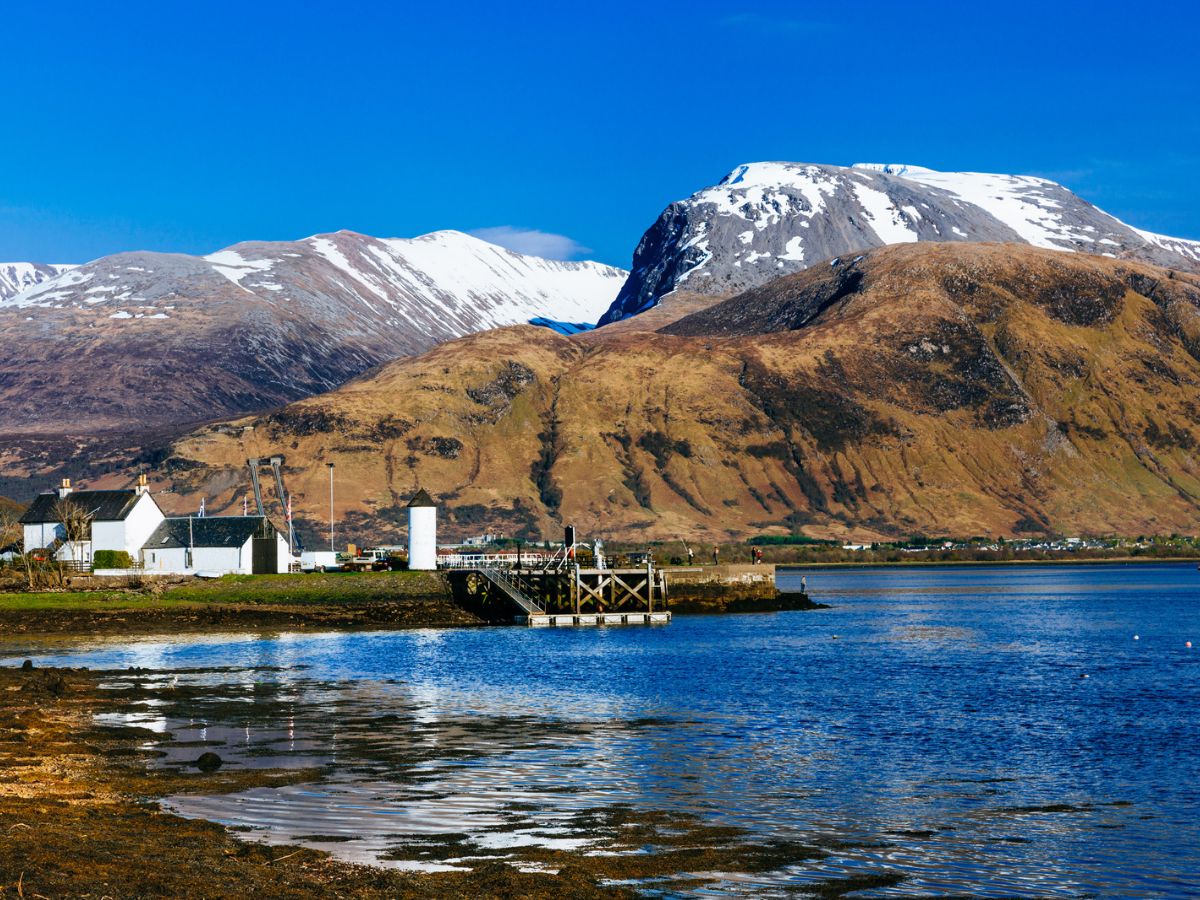

Short answer: climbing Ben Nevis by the Mountain Path is a long, strenuous hillwalk, not a technical climb. It is about 16.5 km with 1,370 m of ascent, and a first-timer should plan for 7 to 9 hours. Most walkers who are fit, start early and carry the right kit manage it. The dangers are weather, navigation and the descent, so know when not to go.
Ben Nevis is the highest mountain in Britain at about 1,345 m, and one of the most visited. That brings two kinds of advice: it is “just a walk”, and it kills people. Neither helps you decide. This guide gives you the numbers, the route, the real risks with sources, and a clear list of days when you should stay off the hill.
We cover the standard Mountain Path from Glen Nevis, which is the route nearly everyone means when they say they are climbing Ben Nevis. The Càrn Mòr Dearg Arête, the Ledge Route and the north face are mountaineering routes and are not covered here.
How hard is Ben Nevis?
Walkhighlands grades the Mountain Path at three boots, calling it “straightforward, if strenuous, by hillwalking standards”. There is no scrambling, and the path is clear for most of the way. What makes it hard is the scale. You start near sea level and climb for hours, the upper half is rough and stony, and the summit is often in cloud while the car park is dry.
| Mountain Path | Figure |
|---|---|
| Distance | 16.5 km (about 10 miles) |
| Ascent | 1,370 m |
| Time | 4 to 9 hours depending on pace and conditions. Plan for 7 to 9 on a first attempt. |
| Walkhighlands grade | Three boots, bog factor 3.5 out of 5 |
| Start | Glen Nevis Visitor Centre car park, about 80 spaces, roughly £3 to £8 a day, fills early in summer |
| Bus | N42 from Fort William, May to September only |
| Best months | May to September. Snow and ice can occur from October to May. |
Distance and ascent come from Cairnova’s route guide. Walkhighlands gives 17 km and 1,352 m, and the Ben Nevis Visitor Centre says about 16 km. For time, our guide lists 4 to 6 hours, Walkhighlands says 7 to 9 and the Visitor Centre gives an average of 7 to 8. The shorter figure only suits a fast, fit walker with few stops, so use the longer one when you plan. Our routes are digitally mapped from public data and not yet field-verified.
How long does it take to climb Ben Nevis?
Plan for 7 to 9 hours for the round trip, plus breaks. Our guide lists 4 to 6 hours, which is the quick end of what people report. Walkhighlands gives 7 to 9 hours, and the Visitor Centre gives an average of 7 to 8. The descent takes longer than most people expect, and Walkhighlands warns that it can be as tiring as the climb.
Fast times exist, but they belong to trained runners. The Visitor Centre says the Ben Race winner takes about 90 minutes, and a walker attempting the Three Peaks challenge in 24 hours needs to do Ben Nevis in 5 hours or less. For a normal walking day, do not plan around either.
Start early. Walkhighlands advises setting off early, allowing at least 6 to 8 hours and avoiding a return in darkness. Daylight shrinks quickly from late autumn.
The Mountain Path, stage by stage
1. Glen Nevis Visitor Centre to the zig-zags
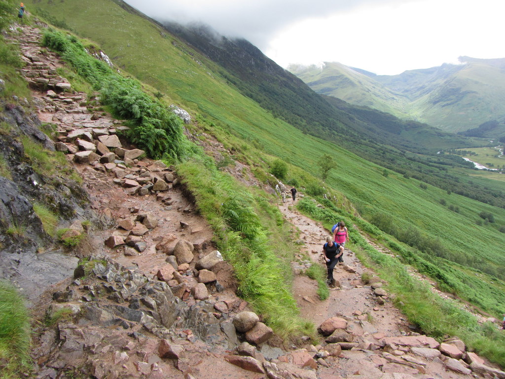
From the car park, cross the bridge over the River Nevis, turn right along the bank, then take a path between a wall and a fence. A wide path climbs across the hillside, then steepens into zig-zags with views of the Mamores. This stage is steady and the path is obvious.
2. The Red Burn to the Halfway Lochan
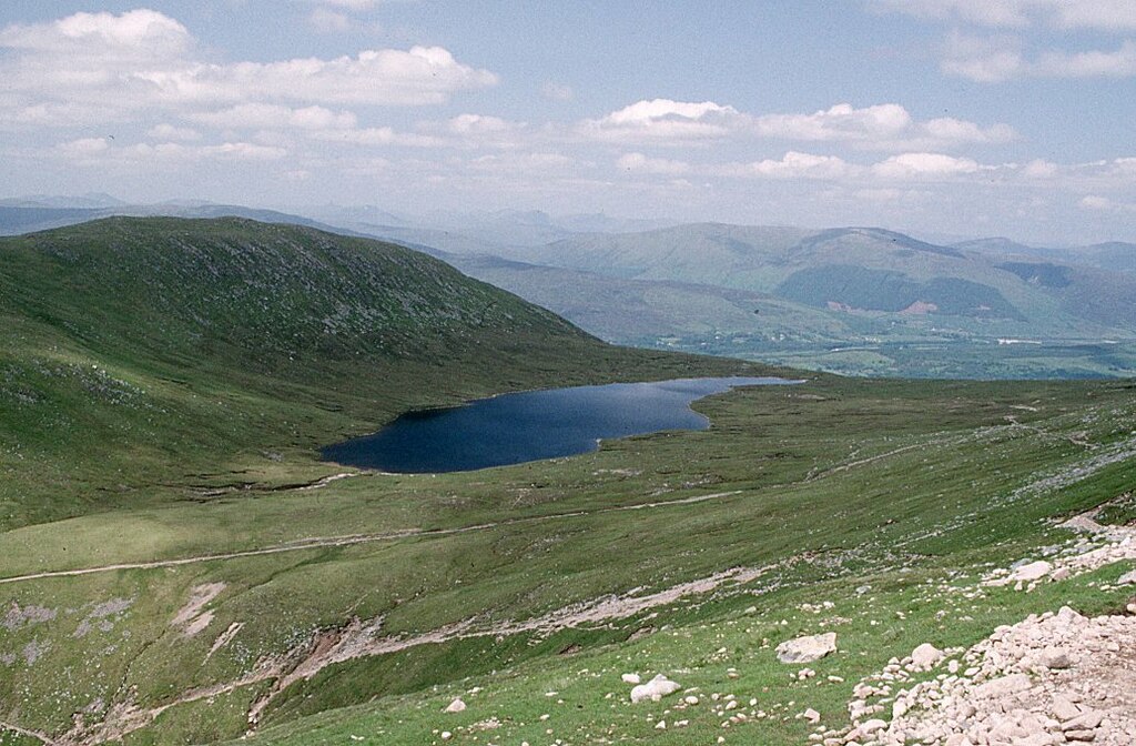
Two footbridges cross small streams, and the path climbs above the Red Burn. Near its head the path turns sharply left. Do not follow the eroded old path straight ahead. The correct path leads to a plateau holding Loch Meall an t-Suidhe, known as the Halfway Lochan, and keeps well to the right of the loch.
3. The upper mountain
At the junction, turn right. The left branch runs below the North Face. You cross the upper Red Burn, then the ground turns to boulders and scree, and the path climbs in wide zig-zags. Stay on the path, because the slopes are eroded. Higher up, the path passes steep scree above the head of Five Finger Gully. Walkhighlands says there have been many fatalities here on the descent, usually when walkers drift too far south while trying to avoid the North Face.
4. The summit plateau and the descent
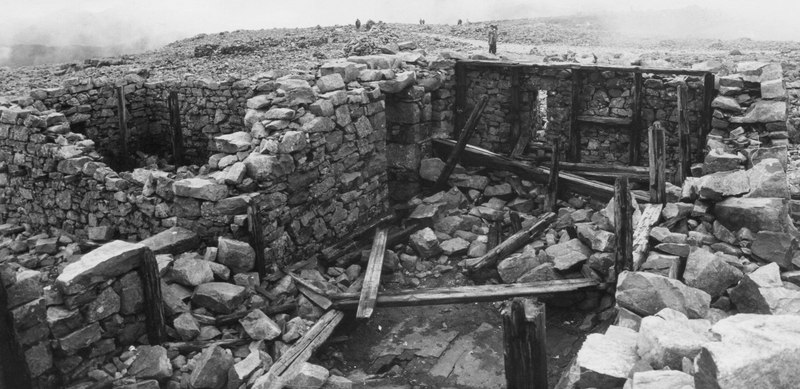
The gradient eases onto a wide summit plateau. You pass the tops of Tower Gully and Gardyloo Gully before reaching the summit, which has a trig point, cairns, memorials and the ruins of an old weather observatory. There is no café. The north-east face has cliffs of about 610 m, and in snow there can be cornices, which are overhanging lips of snow that can collapse. Cairnova’s guide lists cornices in Coire Leis in winter. Keep well back from the edge.
Return the way you came. In mist, or with snow on the path, the navigation is the hardest part of the day. Walkhighlands gives a bearing of 231° for 150 m, then 281°, to pass between Gardyloo Gully and Five Finger Gully. Check where those bearings start against its route page and a current map before you rely on them, and practise with a map and compass before the day, not on the summit.
When not to climb Ben Nevis
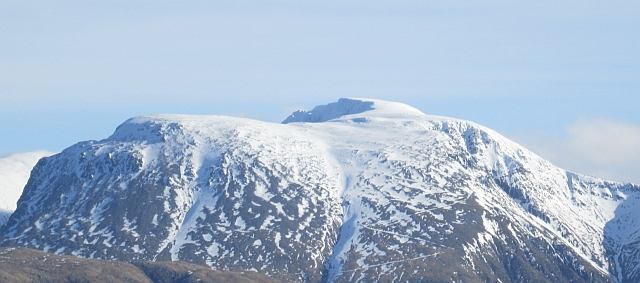
The easiest way to stay safe on Ben Nevis is to know in advance which days to skip. Stay off the mountain, or choose a lower hill, if any of these apply:
- Snow is lying on the path. Walkhighlands says any ascent with snow on the path needs winter equipment and skills. Our guide lists snow and ice from October to May, and it makes the summit plateau much harder to navigate.
- The summit forecast is poor. Check the mountain forecast, not the Fort William town forecast. The Visitor Centre says the mountain weather report is updated twice daily. Strong wind, heavy rain or low cloud on the summit are all reasons to turn back or not start.
- You cannot navigate with a map and compass. Visibility on the summit can drop to a couple of metres. A phone is not enough, because reception is patchy.
- You are starting late. If you cannot finish before dark, do not start. Walkhighlands lists returning in darkness as a common cause of accidents.
- You are not fit enough for a 7 to 9 hour day. Overestimating fitness is another cause Walkhighlands names.
- You do not have the kit. Jeans, trainers and a thin jacket are not enough on the summit, even in summer.
Turning back is not failing. Set a turn-around time before you start and keep to it. Reaching the summit is optional. Getting back is not.
Is Ben Nevis dangerous?
Ben Nevis is a serious mountain, not a dangerous one if you treat it properly. Most people who climb it finish without trouble. When the rescue team looks back on its busy seasons, the causes it names are falls on rock and ice, avalanches, severe weather, difficult terrain and walkers who were not prepared.
Walkhighlands lists the common causes of accidents: overestimating fitness, returning in the dark, changeable weather and low cloud, taking the wrong route near the Halfway Lochan or the summit, and getting too close to the edges.
The numbers help to keep the risk in proportion. The Lochaber Mountain Rescue Team says it responds to more than 150 call-outs a year. In 2022 the team had 120 call-outs and rescued 143 people, according to the Press and Journal, and almost two-thirds of the rescues were on Ben Nevis. Visitor numbers in the area have doubled in the last twenty years, according to the Scottish Mountain Rescue organisation, so the number of incidents has risen with them. These figures cover everyone on the mountain, including climbers on technical routes and winter climbers, not only walkers on the Mountain Path.
For the practical risks on the path itself, the answer is the same as above: do not go in bad conditions, do not go without navigation skills, and do not drift south of the path on the descent.
What to carry for Ben Nevis
This follows the Walkhighlands safety advice, which is based on what the Mountain Path needs:
- Navigation: an OS map (Explorer 392), a compass and the skill to use them. Walkhighlands advises against relying on one phone or app.
- Waterproof jacket and trousers, a warm mid-layer, a warm fleece-type jacket, hat, gloves and thick socks. Not jeans.
- Walking boots with good grip. The upper path is rough and stony.
- Food and at least 2 litres of water. The Visitor Centre says stream water is untested.
- Head torch, whistle, first aid kit and a survival bag.
- A route card left with someone, saying where you are going and when you expect to be back.
In an emergency, call 999 and ask for the police, then mountain rescue.
Check the mountain before you go
The route does not change much, but the conditions on the day decide whether it is a good idea. Our Ben Nevis guide has a 7-day and hourly forecast, live conditions, a hazard assessment, route maps with elevation profiles, GPX downloads, parking, transport and safety information. Mountain Intelligence also has an interactive 3D map where you can explore the route. Check the forecast and read the safety notes the evening before and again in the morning.
If you are new to the hills, our guide to the easiest Munros for beginners is a better first step.
Frequently asked questions
How many people have died on Ben Nevis?
We could not find a single official total that we can verify, so we do not give one. For the Lochaber Mountain Rescue Team’s whole area in 2022, the Press and Journal reported nine deaths among 120 call-outs. Those figures include climbers on technical and winter routes as well as walkers, and cover more than the Mountain Path.
Can a beginner climb Ben Nevis?
Yes, in good summer conditions, if you are fit enough for a 7 to 9 hour day, can navigate with a map and compass and carry proper kit. If you are unsure, go with a guide. The Visitor Centre recommends booking one. Do not choose Ben Nevis as your first-ever hill walk.
Is Ben Nevis a difficult hike?
It is strenuous rather than technical. The Mountain Path is graded three boots by Walkhighlands, with no scrambling, but it is about 16.5 km with 1,370 m of ascent and rough ground near the top. The difficulty comes from the length, the weather and the navigation in cloud.
Can someone unfit climb Ben Nevis?
It is not a good idea. You climb about 1,370 m and then have to come back down. Advnture suggests 12 to 20 weeks of training for people new to hiking. Build up with shorter hill days first, such as the hills in our beginners guide.
Can a 70-year-old climb Ben Nevis?
There is no age limit, and fit older walkers climb it. The question is fitness, kit and conditions, not age. Allow a full day, choose a settled summer weather window, set a turn-around time and consider going with a guide or a more experienced walker.
Can you just turn up and walk Ben Nevis?
You do not need a permit or to register, unless your group has 10 or more people, according to the Visitor Centre. You should still check the forecast, carry navigation and kit, leave a route card and arrive early enough to finish in daylight.
Can you climb Ben Nevis in 2 hours?
Not as a normal walker. The Ben Race winner takes about 90 minutes, and that is a trained fell runner on a race day. For a walk, plan for 7 to 9 hours.
Can you get phone signal on Ben Nevis?
Sometimes. The Visitor Centre says reception is patchy and missing on some sections of the path, and our guide lists signal as poor to none above 600 m. Do not rely on it for navigation. Carry a paper map and compass, and download offline maps as a backup. If you may need to call for help without signal, text REGISTER to 999 before you travel to sign up for the emergency SMS service, and share your location using what3words or a grid reference.
What if I need the toilet on Ben Nevis?
There are no toilets on the mountain, and no litter bins. There are toilets at the Glen Nevis Visitor Centre at the start, so use them before you set off, and take all your rubbish and any toilet paper back down.
Can dogs hike Ben Nevis?
Yes, ideally on a lead. The Visitor Centre says sheep graze up to about 700 m and the scree on the upper path can hurt paws. In 2022 mountain rescuers had to carry a large dog off the summit after she injured her paws, so be realistic about what your dog can manage.
How many people climb Ben Nevis a year?
There is no official count, and estimates vary. Countryfile gives about 125,000 and Advnture about 150,000. The Visitor Centre says some days see over 1,000 people on the mountain.
Is Ben Nevis a mountain or a Munro?
Both. It is a mountain, and as a Scottish mountain over 3,000 feet (914.4 m) it counts as a Munro. At about 1,345 m it is the highest Munro and the highest mountain in Britain.
What is the deadliest mountain in the UK?
There is no official ranking. Ben Nevis appears often in rescue figures because so many people climb it, and almost two-thirds of the Lochaber team’s 2022 rescues were there. Numbers of deaths depend on how many people are on a mountain, not only how dangerous it is.
How we checked these numbers
Distance, ascent, parking, public transport, facilities and seasons come from Cairnova’s Ben Nevis guide, whose routes are digitally mapped and not yet field-verified. The grade, time range, route description and bearings come from the Walkhighlands Mountain Path page, and the safety advice from the Walkhighlands Ben Nevis safety notes. Practical details on time, phone signal, dogs, registration and visitor numbers come from the Ben Nevis Visitor Centre FAQs. The 2022 rescue figures come from the Press and Journal’s report on the Lochaber Mountain Rescue Team, the annual call-out figure from the Lochaber Mountain Rescue Team and the visitor trend from Scottish Mountain Rescue. Visitor estimates and the training advice come from Countryfile and Advnture. Figures differ between sources, and we say which one we use. Last checked October 2026.
Planning your climb? Open the interactive 3D map on Cairnova Mountain Intelligence to explore the route, then check the summit forecast and safety information before you set off.
